AT A GLANCE
- Known for
- Aerial photographs of how Americans use the land: farms, suburbs, highways, places of play and the signs of climate change
- Works in
- Color
- Camera
- A hand-held 35mm camera, used from the window of his own small plane
- Also
- Trained architect (Harvard, 1973); founder of Landslides Aerial Photography; author of eleven books
- Start with
- OVER: The American Landscape at the Tipping Point (Abrams, 2008)
- Links
Alex MacLean (born 1947) is an American pilot and photographer. Trained as an architect, he has flown his own plane over the United States since the 1970s. His aerial pictures show the patterns people leave on the land, from farm fields to city grids, and what those patterns say about how we live.
The story
One day Alex MacLean was flying his small plane from Hanscom Field in Bedford, Massachusetts, to the coast at Revere. Over Medford he saw a huge knot of roads below him. He had driven through that intersection before. From the car it was just traffic. Now it was freshly paved, with new lines on dark asphalt, and from the air it looked crisp and strange. He photographed it.
He was born in Seattle in 1947 and spent part of his childhood on an 11-acre hobby farm outside Washington, D.C. At Harvard he took up photography. While studying architecture there, he spent a summer as a counselor at a flight school in Florida owned by a friend’s uncle. By the end of those months he had a pilot’s license.
After his degree in 1973 he worked in a landscape architecture office in Syracuse. But he soon knew he would rather be in the air. In 1975 he got his commercial pilot license and started Landslides Aerial Photography. He sold pictures to university slide libraries, then flew jobs for architects and planners. “The commercial work is really like target practice,” he said.
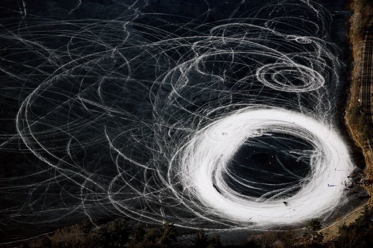
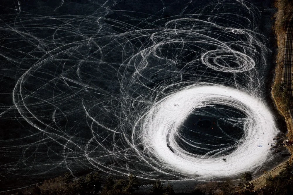
So the personal pictures come in between. He opens the window, holds the camera and steers with his feet. Often he does not know what he will find. “It’s sort of like fishing,” he once explained. “If you’re out there a lot, you catch things.” One winter day in 1989, the catch was a frozen pond in southeastern Massachusetts, scratched with the white loops of motorcycles.
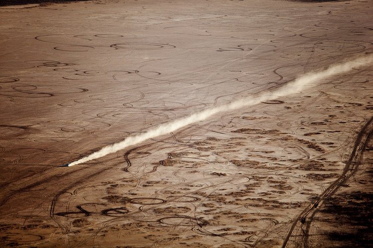
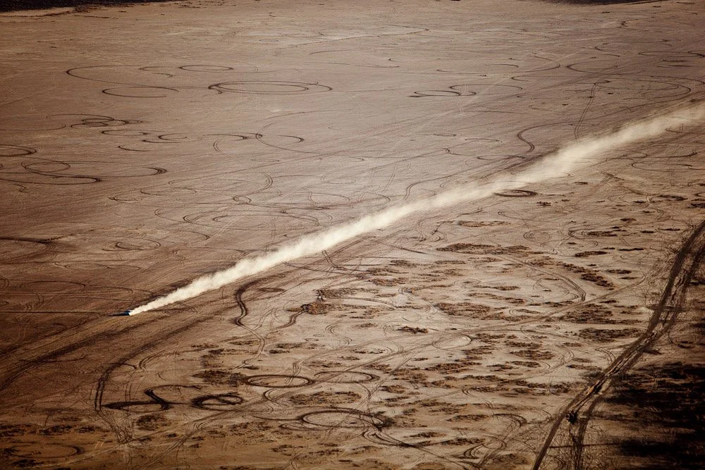
Over the years, the patterns began to worry him. He saw sprawl, highways and golf courses watered in the desert. For his 2008 book OVER: The American Landscape at the Tipping Point, he flew over Arizona, New Mexico and Nevada for years. The desert kept pulling him back. In Clark County, Nevada, in 2009, a single car pulled a long line of dust across ground covered with old tire tracks.
The interchange in Medford was a place he already knew. From above, the familiar road became a clue. Most of his pictures work like that, even when no person is in them. “What I see is tracks and markings that are telling about our culture and values,” he says.
The work

- 1947Born in Seattle, Washington
- 1973Earns a Master of Architecture from Harvard Graduate School of Design
- 1975Gets his commercial pilot license and soon founds Landslides Aerial Photography
- 1996Publishes Taking Measures Across the American Landscape with James Corner
- 2003Wins the Rome Prize in Landscape Architecture (2003–2004)
- 2008Publishes OVER: The American Landscape at the Tipping Point
- 2009Receives the CORINE International Book Award
- 2012Publishes Up on the Roof: New York's Hidden Skyline Spaces
- 2024Shows in the group exhibition Notions of Home at Yancey Richardson, New York
Lessons
Treat paid work as practice. MacLean calls his commercial jobs for architects and planners target practice. Every assignment trains his eye and his flying.
Go out often and stay open. He says there is a lot of chance discovery when he flies. He compares it to fishing: if you are out there a lot, you catch things.
Let beauty carry the message. He wants his pictures to be alluring first, so people look longer. Then they start to think about what they are really seeing.
Try this: find a high place, like a bridge, a hill or an upper window, and look down at somewhere you know well, such as a parking lot or a crossroads. Photograph only the marks people leave: tracks, lines and shadows. Keep the people out of the frame.
Gear
MacLean flies and photographs at the same time, usually alone. Sources describe his planes and his way of working more than specific camera models.
Cessna 172: his first plane, bought once his aerial photography business picked up.
Cessna Skylane 182: by 2001 he had flown more than 5,000 hours in this single-engine plane, often at 1,000 to 2,000 feet.
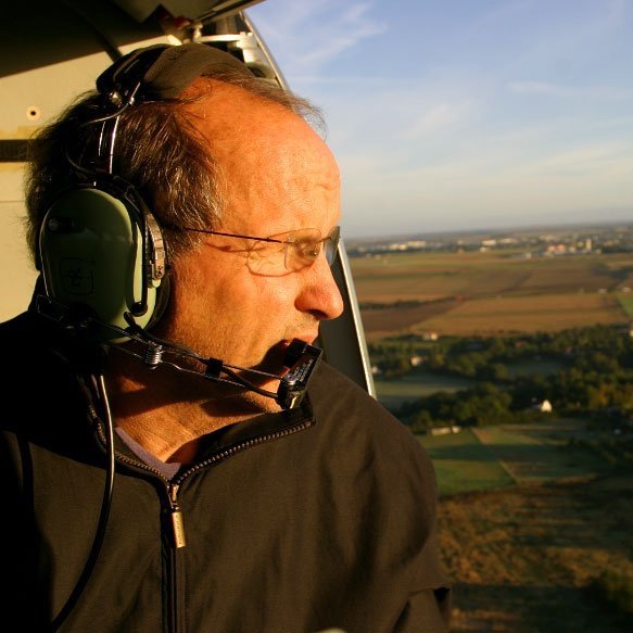
35mm camera: he rests it on his left shoulder, holds it with one hand and often takes his other hand off the yoke to steady it, steering with his feet.
In 2009 Harvard Magazine pictured him with a new fuel-efficient plane. He keeps his plane at Hanscom Field in Bedford, Massachusetts.
Books
OVER: The American Landscape at the Tipping Point (Abrams, 2008). His seventh book, with an introduction by the environmentalist Bill McKibben. Hundreds of aerial photographs are arranged in nine chapters on topics such as energy and sprawl, and each chapter opens with a short essay by MacLean. Captions explain the environmental meaning of each scene: refineries, highways, mansions outside Pittsburgh, rows of RVs in Arizona, golf courses in the desert. Years of flights over Arizona, New Mexico and Nevada, funded in part by the Lincoln Institute of Land Policy, are at its heart. The best place to see how his beautiful patterns carry a warning about climate change.
Designs on the Land: Exploring America from the Air (Thames & Hudson, 2003). A thick survey of 367 pages with more than 400 color photographs and texts by MacLean and other writers. It covers thirty years of flying over the American land: desert spaces, farm patterns, city grids, pollution, sprawl and the way surfaces and activities overlap. A good overview for anyone interested in landscape, planning or abstract patterns in photography.
Up on the Roof: New York's Hidden Skyline Spaces (Princeton Architectural Press, 2012). Here MacLean flew low around Manhattan and its neighbors in a helicopter, with someone else at the controls, and photographed the roofs of 183 buildings. You see water towers, pools, tennis courts, gardens, a one-acre farm, a model World War I biplane and the camouflage roof of MoMA. Maps and captions help locate each roof, and an essay by the architecture critic Robert Campbell puts the work in context. MacLean calls the roof “a fifth facade” and argues that most of them are underused. A fun book for city lovers and anyone interested in green cities.
In his words
“For me, the art of aerial photography is the experience of piloting myself through three-dimensional space to find the perspective that brings light, atmosphere, and pattern together to make a meaningful, two-dimensional composition.”
“There is a lot of chance discovery when I’m flying.”